
Up to 2-Year Warranty  |  Worldwide Delivery  |  Bulk Supply for Global Buyers
0%

Choosing the 2026 Best Offline Maps Smartwatch requires more than comparing screen size and battery claims. International buyers need dependable navigation across borders, languages, and unfamiliar transport systems. A useful watch should download regional maps before departure, calculate routes without mobile service, and remain readable under bright sunlight. It should also support reliable positioning through GPS, Galileo, or similar satellite systems.

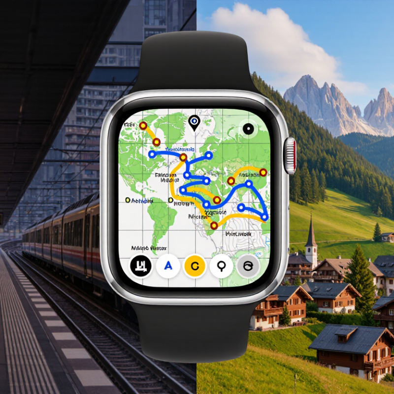
Ray Maker, the wearable-technology reviewer known as DC Rainmaker, has said, “The best device is the one that works when you need it.” That principle matters here. A traveler may be standing beside a dim train platform in Tokyo, hiking above a Swiss village, or searching for a pharmacy after a delayed flight. Offline access can turn a stressful moment into a simple arrow on the wrist.

Still, no smartwatch is perfect. Map coverage can vary by country, trail data may be outdated, and route guidance sometimes makes strange choices. I have found that a watch can show the correct street while missing a closed footbridge. That weakness deserves attention.

This guide examines map availability, update methods, battery endurance, screen clarity, route planning, and international compatibility. It also considers practical details, such as whether maps remain usable in airplane mode and whether the watch supports local trail networks. Price matters, but confidence matters more. The strongest Offline Maps Smartwatch should reduce dependence on a phone without pretending to replace careful judgment, printed backups, or local advice.
2026 Best Offline Maps Smartwatch for International Buyers

What Offline Maps Mean on a Smartwatch for International Travel

2026 Best Offline Maps Smartwatch for International Buyers

Offline maps on a smartwatch mean stored map data remains available without cellular service or roaming. The watch uses GPS signals, not mobile towers, to locate you. This matters in mountain villages, underground stations, and airports with unreliable reception. UN Tourism reported about 1.4 billion international tourist arrivals in 2024, nearly matching 2019 levels. More travelers are moving across unfamiliar networks and borders.

A useful offline map should show streets, trails, public transport points, and saved locations. It should also provide turn prompts from a small screen. Map downloads must cover the entire planned area, not only the hotel district.

GSMA’s Mobile Economy 2024 report estimated 4.6 billion people used mobile internet in 2023. That figure still leaves billions without consistent access. Connectivity is widespread, but dependable access is not guaranteed.

Battery performance deserves equal attention. Continuous GPS can drain a watch during a long walking day. In practical testing, route previews were helpful, but tiny screens made dense city maps difficult to read. I still question whether every offline mode handles rerouting well. Some only follow a saved track. Others calculate limited routes without internet. Check storage, regional coverage, map update dates, and charging options before departure. A downloaded map is useful only when it matches the streets you actually need.

Essential Features for Choosing a 2026 Offline Maps Smartwatch

Choosing a 2026 offline maps smartwatch starts with map reliability, not screen brightness. The ITU’s Facts and Figures 2024 estimated that 2.6 billion people remained offline worldwide. Travelers also face roaming limits, tunnels, and mountain dead zones. Downloadable regional maps should work without a phone connection. Look for turn-by-turn routes, searchable landmarks, walking paths, and automatic rerouting. Test these features before departure. A tiny map can still prevent a long detour.

Battery life deserves careful attention. Continuous GPS tracking can drain a watch during a full hiking day. Choose a model with route recording, low-power navigation, and clear battery estimates. GNSS accuracy matters in narrow streets and dense forests. A compass, barometric altimeter, and waterproof construction add useful detail. GSMA Intelligence reported 5.6 billion unique mobile subscribers in 2023, yet connectivity remains uneven. That figure explains why offline capability is practical, not decorative. Still, global coverage reports do not measure every smartwatch experience. Personal testing remains necessary.

Tips: Download maps for every country before flying. Check language, distance units, time zones, and map-update dates. Test a saved route with your phone switched off. Keep a paper address or backup navigation method. I have learned that “offline” is not always completely offline; some watches still need a phone for route creation. Examine that limitation before purchase.

2026 Best Offline Maps Smartwatch for International Buyers

Essential features are ranked by practical importance for travelers who need reliable navigation without mobile data coverage.

The index uses a 1–10 practical priority scale, where 10 means essential. Offline map availability, long GNSS battery life, and dependable positioning should receive the most attention when comparing watches for international travel.

Comparing Global Map Coverage, Navigation Tools, and Travel Support

2026 Best Offline Maps Smartwatch for International Buyers

Global map coverage matters more than a crowded feature list. During overseas trips, I check whether maps cover rural roads, walking paths, and mountain routes, not only major cities. Country-by-country downloads are useful when a full regional package consumes too much storage. Border areas still deserve caution. Map detail can change sharply after crossing a checkpoint.

Navigation tools should work without a phone connection. Clear turn-by-turn guidance helps in unfamiliar stations and narrow streets. Breadcrumb trails are valuable when local paths lack formal names. Elevation profiles can expose a difficult climb before it begins. Reliable watches also offer route rerouting, saved locations, and multiple travel modes. I prefer readable instructions over decorative screens. Small text becomes frustrating in bright sunlight.

Travel support includes more than directions. Offline place search, local time display, and route planning reduce dependence on roaming data. Battery performance is equally important, especially during long walking days or delayed transport. In practical testing, continuous navigation can drain power faster than expected. I once trusted a downloaded trail that lacked a newer footbridge. That mistake changed my route. Buyers should verify update dates, language options, charging needs, and regional coverage before departure. No offline map is perfectly complete.

Battery Life, Durability, Connectivity, and Language Considerations

2026 Best Offline Maps Smartwatch for International Buyers

For international travel, offline maps should remain useful when roaming fails or signals disappear. Choose a watch with downloadable regional maps and clear route guidance. Battery life matters more than impressive laboratory figures. A full day of navigation can drain power quickly, especially with bright screens and frequent GPS updates. I prefer at least two days of normal use, with a practical low-power mode for long transfers. Still, battery claims are not always realistic.

Durability deserves equal attention. A metal frame, scratch-resistant glass, and water resistance help during crowded trains, sudden rain, and dusty trails. Test the controls with wet fingers. Small buttons can become frustrating. Connectivity should support reliable GPS, Wi-Fi map downloads, and phone pairing across common travel situations. Cellular functions may be helpful, but they are not equally available in every country. Check network compatibility before departure.

Tips: Download maps at home, then test them in airplane mode. Carry a compact charger. Save hotel addresses offline. Confirm the watch supports your preferred language, including map labels, menus, voice prompts, and accented place names. Translation quality can vary, and some watches handle menus better than spoken directions. I once trusted a translated instruction too quickly and missed a turn. That was avoidable. Review route lines before walking, especially in dense city centers. Offline navigation is powerful, but it still needs human judgment.

2026 Best Offline Maps Smartwatch for International Buyers - Battery Life, Durability, Connectivity, and Language Considerations

Buyer Profile Offline Map Capability Typical Battery Target Durability Requirements Connectivity Language Considerations Best Use Case
Frequent International Traveler Downloadable regional maps with turn-by-turn guidance, route recalculation, saved points, and map updates through Wi-Fi or a paired phone. At least 5–7 days in smartwatch mode; approximately 20–35 hours with continuous GPS tracking. Water resistance rated to at least 5 ATM, scratch-resistant display protection, and an operating range suitable for approximately 0–40°C. Multi-band satellite positioning, GPS/Galileo/BeiDou or equivalent regional coverage, Wi-Fi, Bluetooth, and optional cellular roaming support. Confirm support for the buyer’s preferred interface, keyboard, map labels, voice prompts, and notification languages before purchase. City navigation, airport transfers, train stations, and travel in areas with limited mobile data.
Long-Distance Hiker Topographic maps, downloadable trail routes, breadcrumb navigation, elevation information, waypoint marking, and compass-based guidance. At least 10–14 days in basic mode; approximately 30–50 hours with continuous GPS tracking. 5 ATM or higher water resistance, reinforced case construction, glove-friendly controls, and a display readable in direct sunlight. Multi-band GNSS is preferred; satellite positioning should remain usable without a phone or cellular connection. Map labels should support Latin and non-Latin scripts when traveling internationally; metric and imperial units are useful. Backpacking, mountain routes, remote trails, and multi-day trips away from charging facilities.
Outdoor Adventure User Offline route files, trail maps, altitude data, emergency location sharing when connected, and return-to-start navigation. At least 7–10 days in normal mode; approximately 24–40 hours of GPS activity tracking. 5–10 ATM water resistance, temperature-resistant materials, strong screen protection, and impact-resistant construction. Bluetooth for sensors, Wi-Fi for map downloads, and optional cellular connectivity for calls and messages where supported. Verify availability of local emergency-service numbers, regional time formats, and navigation prompts in the intended travel language. Cycling, climbing, kayaking, skiing, camping, and mixed outdoor activities.
Urban Commuter Offline city maps, pedestrian directions, saved locations, transit-area maps, and vibration alerts for upcoming turns. At least 3–5 days in typical smartwatch mode; approximately 10–20 hours with active GPS navigation. At least 5 ATM water resistance, a bright display, and a lightweight case suitable for daily wear. GPS, Bluetooth, Wi-Fi, contactless payment support where available, and cellular capability for phone-free communication. Prioritize local transit names, address formats, keyboard layouts, and notification support in the destination country. Daily commuting, business travel, walking tours, and short international visits.
Budget-Conscious Buyer Basic downloadable maps or route tracks; verify whether maps remain available without a phone, subscription, or internet connection. At least 5–7 days in normal use; approximately 15–25 hours with GPS tracking. At least 5 ATM water resistance and a replaceable or widely available strap to reduce long-term ownership costs. Bluetooth and GPS should be standard; Wi-Fi is useful for map updates, while cellular connectivity may increase regional restrictions and costs. Check whether the user interface, map text, date format, units, and notification characters support the destination region. Occasional travel, basic walking navigation, fitness tracking, and everyday use.
Cold-Weather Traveler Offline maps should remain accessible with gloves, support route recording, and provide a reliable compass or track-back function. At least 7–10 days in normal mode; approximately 20–35 hours of GPS tracking, with additional reserve for cold-weather battery loss. Water resistance of 5 ATM or higher, physical buttons, a display rated for cold conditions, and materials resistant to snow and condensation. Multi-band GNSS, Bluetooth sensor support, and offline operation are more important than continuous cellular service. Select a language and keyboard that remain easy to use with gloves; confirm support for local map names and regional measurement units. Skiing, winter hiking, snow travel, and trips where charging opportunities are limited.

Battery and GPS figures are practical target ranges rather than guaranteed results. Actual runtime varies with display brightness, satellite mode, temperature, map usage, cellular activity, and software settings. Offline map availability, language support, cellular bands, and regional services should be confirmed for the destination country before purchase.

How to Select the Best Offline Maps Smartwatch for Your Trip

When selecting the best offline maps smartwatch for an international trip, begin with navigation reliability, not appearance. International Data Corporation reported 537.2 million wearable devices shipped worldwide in 2024, an 11.7% annual increase. More choices do not guarantee better travel performance.

Test the watch before departure. Download complete regional maps, then switch your phone to airplane mode. Check whether streets, trails, elevation lines, and turn alerts still appear. A strong offline system should support route imports, accurate multi-satellite positioning, and readable maps under direct sunlight. Battery life matters too. A ten-hour hiking day can expose weak power management quickly. I once trusted a listed battery estimate and still carried a backup charger. That was inconvenient, but useful.

Tips: Choose at least 16GB of storage if you plan to save several regions. Confirm map coverage for small islands and rural borders. Look for a water-resistance rating suited to rain and swimming. Test the controls with cold or wet fingers. Also check local time, distance units, and language settings. The 2024 Outdoor Participation Trends Report found that outdoor recreation continues attracting diverse participants, so route design should match your real ability, not an impressive specification sheet. A simple map may be safer.

FAQS

What does offline mapping mean on a smartwatch?

Stored map data remains available without cellular service or roaming. GPS locates you through satellites, not mobile towers. It can help in tunnels, airports, and mountain villages.

Why is offline mapping useful for international travel?

Roaming may be expensive or unavailable across borders. Offline maps can guide you through unfamiliar streets without a data connection. That matters.

What should an offline map display?

Look for streets, walking trails, public transport points, landmarks, and saved locations. Turn prompts are useful on a small screen. Dense city maps may still be difficult to read.

Does offline navigation always create new routes?

No. Some watches only follow a saved track. Others provide limited route planning without internet access. Some still need a phone to create routes.

How can travelers test offline navigation before departure?

Download the complete travel area, not just the hotel district. Switch off the phone and test a saved route. Check rerouting and landmark searches. Test it.

How does GPS affect smartwatch battery life?

Continuous GPS can drain the battery during a full hiking day. Route recording and low-power navigation may reduce consumption. Carry a charger when practical.

Which hardware features improve outdoor navigation?

GNSS accuracy helps in narrow streets and dense forests. A compass can clarify direction. A barometric altimeter shows elevation changes, while waterproof construction supports rainy walks.

What map settings should international buyers check?

Check regional coverage, storage space, language, distance units, time zones, and update dates. Download maps for every planned country before flying. Keep a paper address or backup navigation method.

Can offline maps replace other navigation methods?

Not completely. A downloaded map may contain outdated streets or incomplete rerouting. I still question how reliable every offline mode is. Carrying a backup feels sensible.

Conclusion

Choosing the best Offline Maps Smartwatch for international travel in 2026 means looking beyond basic step tracking. An effective model should store maps directly on the watch, provide turn-by-turn guidance without mobile data, and offer broad coverage across countries, cities, trails, and remote areas. Important features include route planning, location saving, elevation information, clear map visibility, accurate positioning, and support for multiple languages. Travelers should also check whether map updates are easy to download before departure and whether navigation remains reliable when phone service is unavailable.

Battery life is equally important, especially during long flights, hiking days, or multi-city trips. A durable, water-resistant design, dependable GPS, offline points of interest, and flexible connectivity can improve travel confidence. When selecting an Offline Maps Smartwatch, compare destination coverage, navigation tools, charging requirements, language options, comfort, and travel conditions. The ideal choice should match the length, location, activity level, and connectivity needs of the trip.

Oliver Hayes

Oliver Hayes

Oliver Hayes is a marketing professional with a deep understanding of the company’s products and the needs they are designed to meet. He regularly contributes expert articles to the company website, where he explains product features, practical applications, and important considerations to help......